We got to sleep in a little this morning. Partly because the guest house didn’t serve breakfast until 7:00 a.m. as opposed to our usual 6:30. Also, since we were planning on Bekkaku Temple 6 this evening and the distance between lodgings for the next two days were intended to set us up for the full-day, out-and-back roundtrip to Bekkaku Temple 7, it was going to be a relatively easy-ish, low mileage day. We left Nishiyugyo Center just after 8:00 a.m.

Almost immediately we were back on National Route 56 heading to Uwajima City. The sky was overcast, but there was no chance of rain in the forecast today. One funny thing about walking through these valleys along the coast is that you’ll be walking along a valley road with small mountains on either side of you and then look over and see a sign informing you that you’re only 5 meters above sea level. The sea is nowhere in sight, but you’re walking through a potential tsunami zone.
We stopped by Lawson Station to pick up our breakfast pastry aperitifs and something for lunch as we wanted to get to Uwajima City a little after 3:00 p.m. That would give us the option to either visit Bekkaku Temple 6 or Uwajima Castle today, saving the other for tomorrow morning. Trying to get both done today may have been a tall order.
On Route 56, we finally came to Matsuo Tunnel (1,710 meters long). We figured we had the time to bypass it along a mountain path and may even pick up some time.
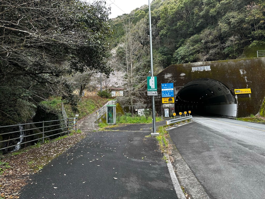
We started out fine, climbing a moderate grade a steady pace. It’s when we reached the “top” of the first leg of climbing where we believe our mistake came. The path split in two – the left over a log bridge cutting sharply back acutely toward the direction from which we came, the right sloping a bit more sharply up in a direction following the tunnel. Quickly looking around and not seeing a henro marker on either path and seeing a pink ribbon trail marker which we’d seen numerous times previously on the trail, I decided to follow the pink markers.
Here’s the thing about the pink ribbon markers. They just mark trails. They don’t just mark the henro michi. Up and up we climbed. They trail was clear and appeared well trod. Then slowly the path started to become a little less clear and harder to follow. We continued on. Maybe the recent rains and wind had washed down the leaves and dropped broken branches in the path. Every once in a while I would see a footprint in the mud and take that as a sign we were headed in the right direction. Funny we weren’t seeing any of the small henro placards hanging in the trees like we had before.
Connor had already been expressing his doubts when we came to a point where the path appeared to split several ways. None of them claiming to the be henro michi. OK. Time to pull out our route guides and navigation apps. We compared where we were according to GPS to where we were supposed to be according to the route guide. We were off the route.
However, comparing the guide and our GPS coordinates, we only appeared to be about a few 100 meters away from the route. While we agreed we weren’t on the route, one of the paths before us appeared to lead in that direction. Connor was in favor of going back, but I was in favor of following the path and seeing what happened. Connor relented.
My reason for following the path was that I considered us to be in the “realm of inconvenience.” We appeared to be only a few hundred meters from the official path, we had a path leading in that direction, we both had working GPS on our phones and paper maps, I had a Garmin InReach GPS tracker with a built-in “SOS” button which could alert local emergency services, if needed, and it was before noon. We had time to correct our issues and were still far from what I would consider the “realm of danger.”
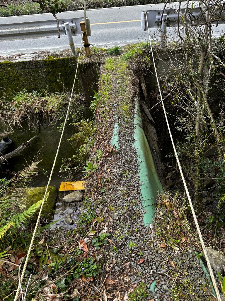
We followed the path west and, while it was passable, it wasn’t in great shape. Bamboo trees had collapsed over the trail and had to be pushed aside. Fortunately, bamboo is light and moved easily. We soon came to some small mad-made reservoirs surrounded by barbed-wire to keep large animals from falling in. Behind it was a large hill overgrown with large, dead grasses. We would have to climb that hill to get to the michi.
Climbing the hill I found myself wishing that my walking staff was a machete instead – a Kukai machete. It was steep and slippery and we were constantly pulling ourselves up the side of the hill by clumps of grass. I heard Connor swearing behind me several times.
As I neared the top of the hill, I saw through the grass what looked like a billboard or something. Billboards mean roads. I called out to Connor and he soon saw it too as we reached a plateau in the hill. Connor then declared, “Next time, we’re just turning back.” I retorted, “But what about the adventure?” (I have a habit of thinking, “This may be a bad idea, but I’m kinda curious to see what happens.”) The structure turned out not to be a billboard, but a small hut similar in size to some of the better built henro huts we’d been visiting. Connor found a small dirt road leading up the the hut.

When we got there, we saw that it was indeed a rest hut, but one for a construction company. Probably for a nearby project. Anyway, it was next to a paved road which we could follow out, so we were essentially almost out of the “realm of inconvenience.” We followed the paved road down in the direction we thought most likely to lead us to the pilgrim road. We were on the road less than five minutes when Connor looked right and said, “Well, that’s pretty damn unambiguous.” We were back to the henro michi.
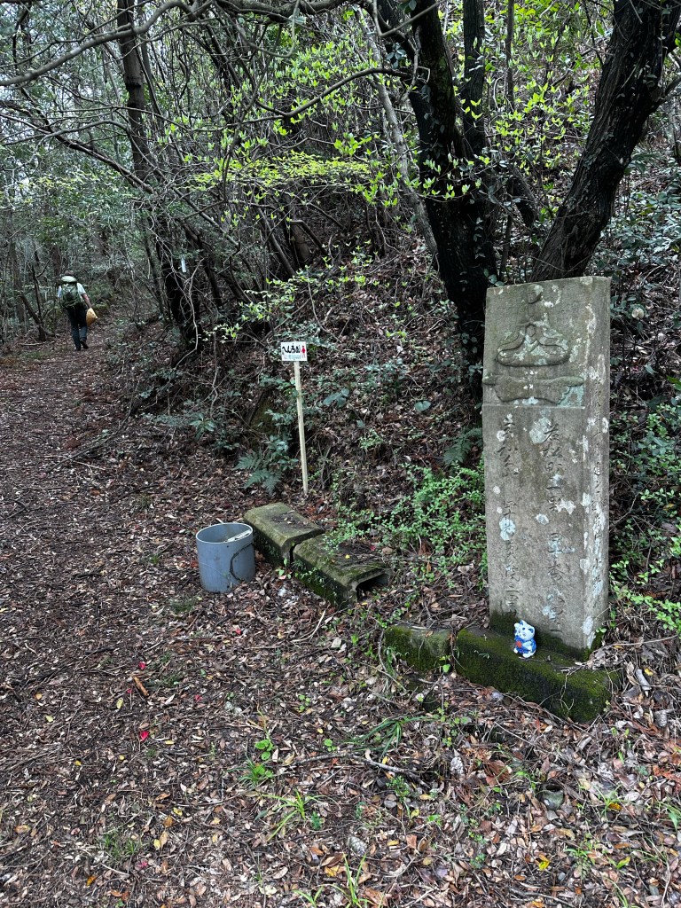
We continued on the trail and stopped to have our snacks and something to drink at one of the henro huts that actually has a name and number – Wanya (26). It was a nice bit hut and I regretted not getting a picture of it.
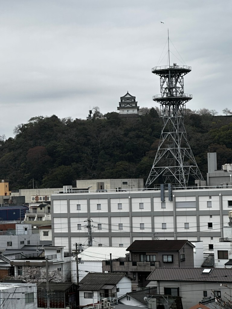
We rejoined civilization not long after and found a Family Mart to get some lunch. The walk to this evening’s inn, Business Hotel Ishibashi, was less than exciting and we arrived after 3:30 p.m. After checking in, we decided to visit the temple and see if we couldn’t save the castle for tomorrow morning.
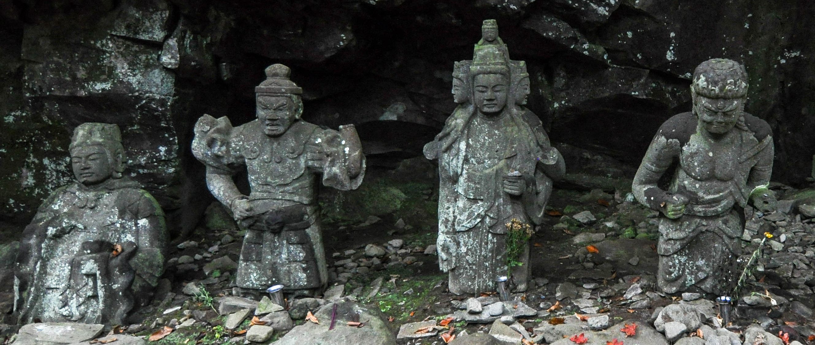
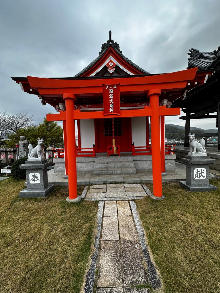
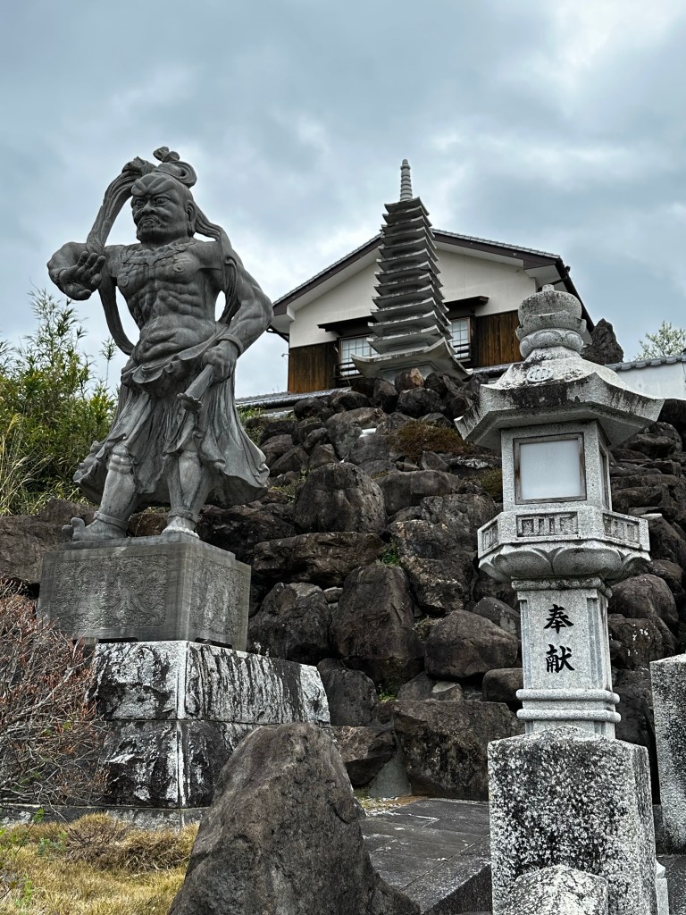
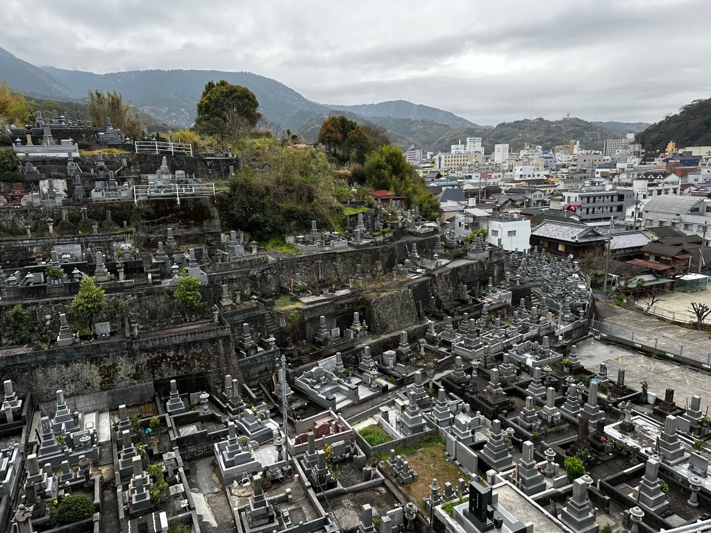
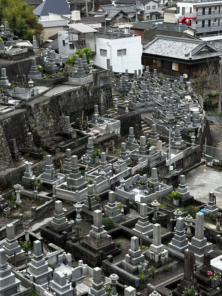
Ryukoin (Bekkaku Temple 6 – “Dragon’s Light Temple”) sits atop a large hill overlooking the city. The next hill over from the temple hill holds a large graveyard climbing in tiered levels from bottom to top.


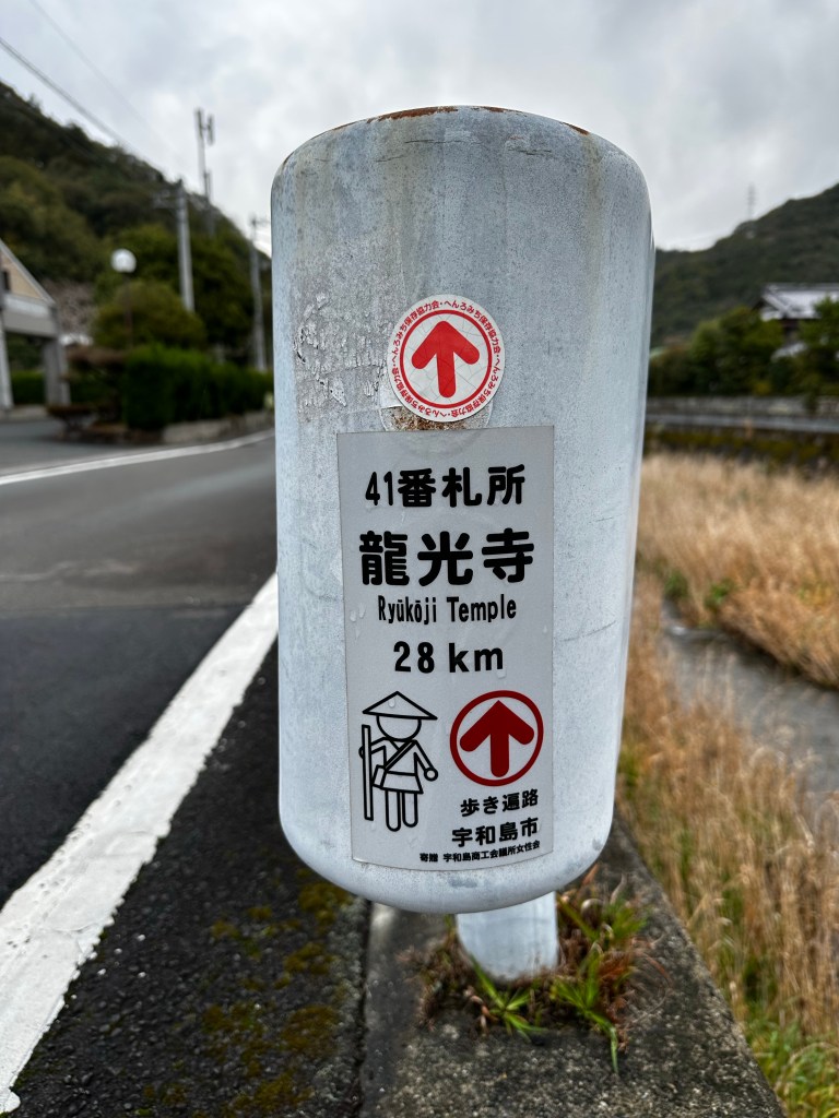
Note: I forgot to mention the following items over the previous two days. Along the pilgrim route, Ehime is referred to as “The Dojo of Enlightenment.” Also, after passing Temple 40, we’re considered to be halfway through the 88 Temple Pilgrimage. We’ve now been to the southernmost and westernmost points along the pilgrim path. We have turned north and will be returning eastward going forward.

Should have listened to Connor. Congratulations on reaching the halfway point (after narrowly averting death).
LikeLike